|
|
Weather Alert |
| Belmont County, OH | |||||||||
|
|
||||||||
|
Canceled 6/6/26 1:40 PM Severe Thunderstorm Warning issued June 6 at 1:28PM EDT until June 6 at 2:00PM EDT by NWS Pittsburgh PA At 128 PM EDT, severe thunderstorms were located along a line from 7 miles northwest of Cadiz to 16 miles south of South Zanesville, or along a line from 7 miles northwest of Cadiz to 20 miles south of Zanesville, moving east at 50 mph. HAZARD...70 mph wind gusts and quarter size hail. SOURCE...Law enforcement reported uprooted trees and power poles down across Muskingum County. IMPACT...Hail damage to vehicles is expected. Expect considerable tree damage. Wind damage is also likely to mobile homes, roofs, and outbuildings. Locations impacted include... Steubenville, Cambridge, Uhrichsville, St. Clairsville, Barnesville, Cadiz, Wellsburg, Caldwell, Freeport, Toronto, Wintersville, Mingo Junction, Dennison, New Concord, Byesville and Dudley. 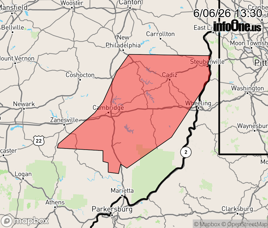 |
|||||||||
 Why aren't you using the InfoOne app? Why aren't you using the InfoOne app?
Stay abreast of information affecting your community! InfoOne tracks real-time information such as:
InfoOne currently supports over 100 communities in NC, VA and WV, and our coverage area is steadily growing. It's free! Install the InfoOne app today and see what you've been missing. |
|||||||||