|
|
Weather Alert |
| Watauga County, NC | |||||||||
|
|
||||||||
|
Canceled 6/26/25 7:42 PM Flood Advisory issued June 26 at 5:50PM EDT until June 26 at 7:45PM EDT by NWS Blacksburg VA * WHAT... Flooding caused by excessive rainfall continues. * WHERE... A portion of northwest North Carolina, including the following counties, Watauga and Wilkes. * WHEN... Until 745 PM EDT. * IMPACTS... Minor flooding in low-lying and poor drainage areas. Dangerous flows over low-water crossings. * ADDITIONAL DETAILS... - At 550 PM EDT, Doppler radar indicated that the heavy rain producing thunderstorms that prompted the advisory have dissipated. However, runoff from this earlier have rain is still expected to prompt flooding flooding within the advisory area. Between 0.5 and 1.5 inches of rain have fallen from this latest round of showers and storms. - This includes the following streams and drainages... Shell Creek, South Fork Laurel Creek, Stony Fork, Mill Creek, Yates Creek, Left Prong Stony Fork, Flat Branch, Dugger Creek, Elk Creek, South Fork New River, South Prong Lewis Fork and Fall Creek. Flooding impacts will continue, but no additional rainfall is expected. - Some locations that will experience flooding include... mainly rural areas of Southeastern Watauga and West Central Wilkes Counties - http://www.weather.gov/safety/flood 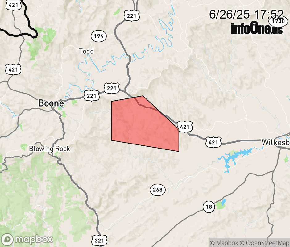 |
|||||||||
 Why aren't you using the InfoOne app? Why aren't you using the InfoOne app?
Stay abreast of information affecting your community! InfoOne tracks real-time information such as:
InfoOne currently supports over 100 communities in NC, VA and WV, and our coverage area is steadily growing. It's free! Install the InfoOne app today and see what you've been missing. |
|||||||||