|
|
Weather Alert |
| Portage County, OH | |||||||||
|
|
||||||||
|
Canceled 5/2/25 2:58 PM Severe Thunderstorm Warning issued May 2 at 2:37PM EDT until May 2 at 3:15PM EDT by NWS Cleveland OH SVRCLE The National Weather Service in Cleveland has issued a * Severe Thunderstorm Warning for... Northwestern Trumbull County in northeastern Ohio... Northwestern Portage County in northeastern Ohio... Geauga County in northeastern Ohio... East central Cuyahoga County in northeastern Ohio... Central Lake County in northeastern Ohio... Southwestern Ashtabula County in northeastern Ohio... * Until 315 PM EDT. * At 236 PM EDT, a severe thunderstorm was located over Chesterland, or 9 miles southwest of Chardon, moving east at 35 mph. HAZARD...60 mph wind gusts and quarter size hail. SOURCE...Radar indicated. IMPACT...Minor damage to vehicles is possible. Expect damage to trees and power lines. * Locations impacted include... Chardon, Mentor, Solon, South Russell, Madison, Middlefield, North Bloomfield, Perry, Burton, West Farmington, Chesterland, Bristolville, Mayfield Heights, Aurora, Lyndhurst, Willoughby Hills, Highland Heights, Kirtland, Pepper Pike, and Parkman. 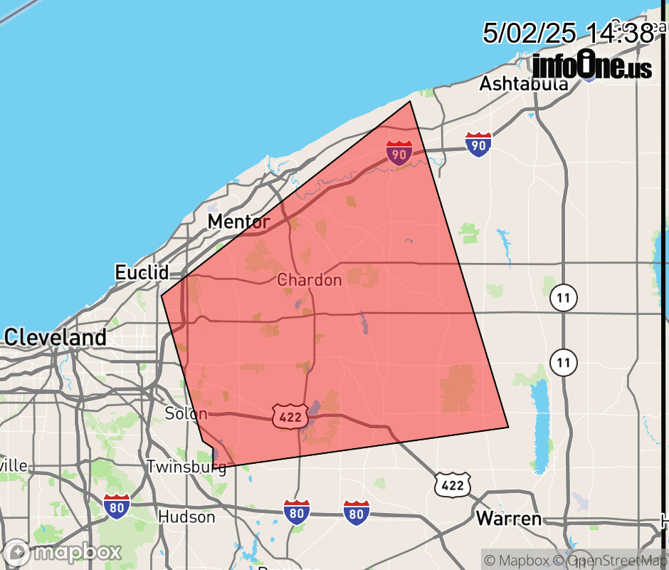 |
|||||||||
 Why aren't you using the InfoOne app? Why aren't you using the InfoOne app?
Stay abreast of information affecting your community! InfoOne tracks real-time information such as:
InfoOne currently supports over 100 communities in NC, VA and WV, and our coverage area is steadily growing. It's free! Install the InfoOne app today and see what you've been missing. |
|||||||||