|
|
Weather Alert |
| Stark County, OH | |||||||||
|
|
||||||||
|
Canceled 6/26/25 9:08 PM Flash Flood Warning issued June 26 at 5:53PM EDT until June 26 at 11:00PM EDT by NWS Cleveland OH FFWCLE The National Weather Service in Cleveland has issued a * Flash Flood Warning for... Northern Holmes County in northeastern Ohio... Southwestern Stark County in northeastern Ohio... Southern Wayne County in northeastern Ohio... * Until 1100 PM EDT. * At 553 PM EDT, Doppler radar indicated thunderstorms producing heavy rain across the warned area. Between 1 and 3 inches of rain have fallen, with rain rates of 2 inches in 30 minutes reported. Additional rainfall amounts up to 1 inch are possible in the warned area. Flash flooding is ongoing or expected to begin shortly. HAZARD...Flash flooding caused by thunderstorms. SOURCE...Radar. IMPACT...Flash flooding of small creeks and streams, urban areas, highways, streets and underpasses as well as other poor drainage and low-lying areas. * Some locations that will experience flash flooding include... Wooster, Millersburg, Massillon, Brewster, Navarre, Shreve, Holmesville, Wilmot, Mount Eaton, Nashville, Winesburg, Apple Creek, Beach City, Fredericksburg and Mount Hope. 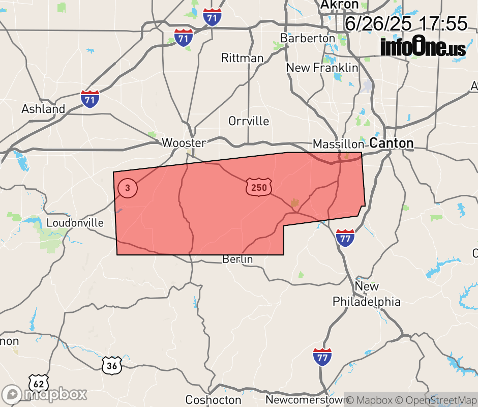 |
|||||||||
 Why aren't you using the InfoOne app? Why aren't you using the InfoOne app?
Stay abreast of information affecting your community! InfoOne tracks real-time information such as:
InfoOne currently supports over 100 communities in NC, VA and WV, and our coverage area is steadily growing. It's free! Install the InfoOne app today and see what you've been missing. |
|||||||||