|
|
Weather Alert |
| Franklin County, OH | |||||||||
|
|
||||||||
|
Canceled 4/29/25 2:18 PM Severe Thunderstorm Warning issued April 29 at 2:03PM EDT until April 29 at 3:00PM EDT by NWS Wilmington OH SVRILN The National Weather Service in Wilmington has issued a * Severe Thunderstorm Warning for... Franklin County in central Ohio... Northern Fayette County in central Ohio... Northwestern Clinton County in southwestern Ohio... Northern Pickaway County in central Ohio... Delaware County in central Ohio... Southeastern Greene County in west central Ohio... Southern Union County in central Ohio... Madison County in central Ohio... * Until 300 PM EDT. * At 202 PM EDT, a severe thunderstorm was located near Springfield, moving east at 55 mph. HAZARD...60 mph wind gusts and penny size hail. SOURCE...Radar indicated. IMPACT...Expect damage to trees and power lines. * Locations impacted include... Port Columbus Airport, Paintersville, East Ringgold, Interstate 71 at State Route 38, Rosemoor, Gahanna, Lumberton, Center Village, Madison Mills, Worthington, Kilbourne, Hilliard, New California, Grandview Heights, Whitehall, Orient, Amity, Ostrander, South Solon, and Delaware. This includes the following Interstates... I-70 in Ohio between mile markers 71 and 111. I-71 in Ohio between mile markers 47 and 138. 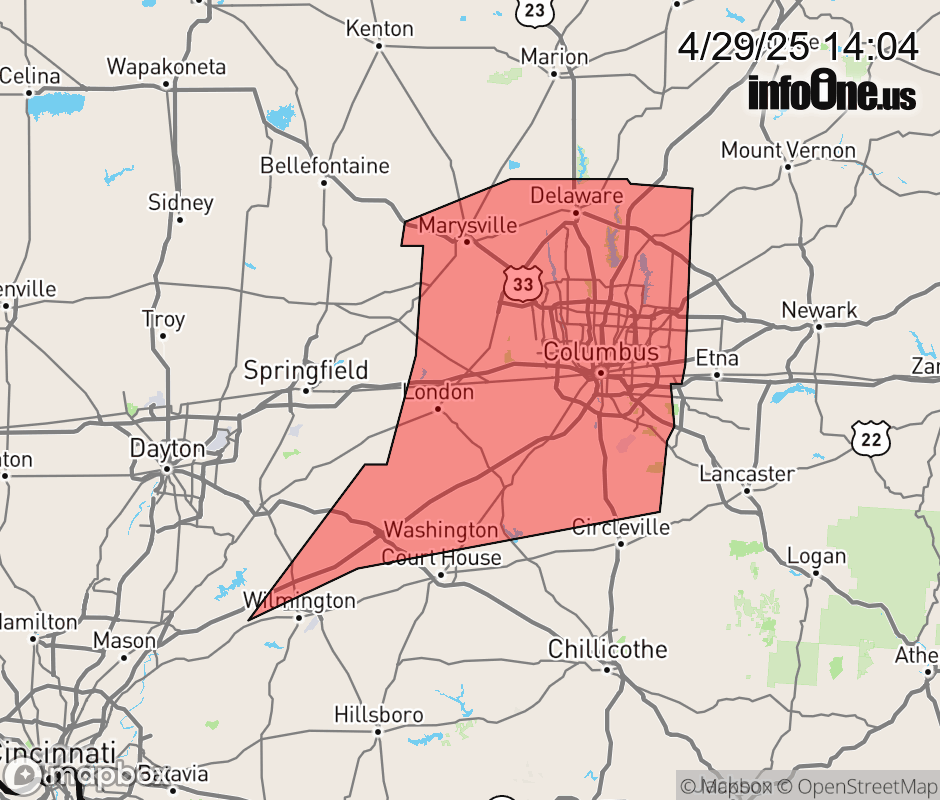 |
|||||||||
 Why aren't you using the InfoOne app? Why aren't you using the InfoOne app?
Stay abreast of information affecting your community! InfoOne tracks real-time information such as:
InfoOne currently supports over 100 communities in NC, VA and WV, and our coverage area is steadily growing. It's free! Install the InfoOne app today and see what you've been missing. |
|||||||||