|
|
Weather Alert |
| Medina County, OH | |||||||||
|
|
||||||||
|
Canceled 4/29/25 8:03 PM Severe Thunderstorm Warning issued April 29 at 7:41PM EDT until April 29 at 8:30PM EDT by NWS Cleveland OH SVRCLE The National Weather Service in Cleveland has issued a * Severe Thunderstorm Warning for... Huron County in north central Ohio... Northern Richland County in north central Ohio... Southeastern Seneca County in northwestern Ohio... Western Medina County in northeastern Ohio... Northern Ashland County in north central Ohio... Northeastern Crawford County in north central Ohio... Southern Lorain County in north central Ohio... * Until 830 PM EDT. * At 740 PM EDT, severe thunderstorms were located along a line extending from near Norwalk to 8 miles west of New London to Bloomville, moving east at 45 mph. HAZARD...60 mph wind gusts and quarter size hail. SOURCE...Radar indicated. IMPACT...Minor damage to vehicles is possible. Expect damage to trees and power lines. * Locations impacted include... Ashland, Norwalk, Willard, Wellington, Lodi, New London, Plymouth, Bloomville, Savannah, Polk, Sullivan, Lagrange, Penfield, Pittsfield, Greenwich, Attica, Spencer, North Fairfield, Bailey Lakes, and Burbank. 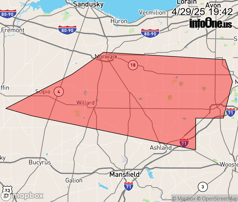 |
|||||||||
 Why aren't you using the InfoOne app? Why aren't you using the InfoOne app?
Stay abreast of information affecting your community! InfoOne tracks real-time information such as:
InfoOne currently supports over 100 communities in NC, VA and WV, and our coverage area is steadily growing. It's free! Install the InfoOne app today and see what you've been missing. |
|||||||||