|
|
Weather Alert |
| Monroe County, OH | |||||||||
|
|
||||||||
|
Canceled 4/29/25 4:53 PM Severe Thunderstorm Warning issued April 29 at 4:39PM EDT until April 29 at 5:00PM EDT by NWS Pittsburgh PA At 439 PM EDT, severe thunderstorms were located along a line extending from 9 miles southeast of Barnesville to 7 miles southwest of Woodsfield, moving east at 50 mph. HAZARD...60 mph wind gusts. SOURCE...Radar indicated. IMPACT...Expect damage to trees and power lines, resulting in some power outages. Locations impacted include... New Martinsville, Woodsfield, Caldwell, Shadyside, Paden City, Powhatan Point, Glen Dale, Sistersville, Dudley, Sardis, Beallsville, Clarington, Summerfield, Macksburg, Lewisville, Sarahsville, Jerusalem, Dexter City, Wilson, and Cameron. 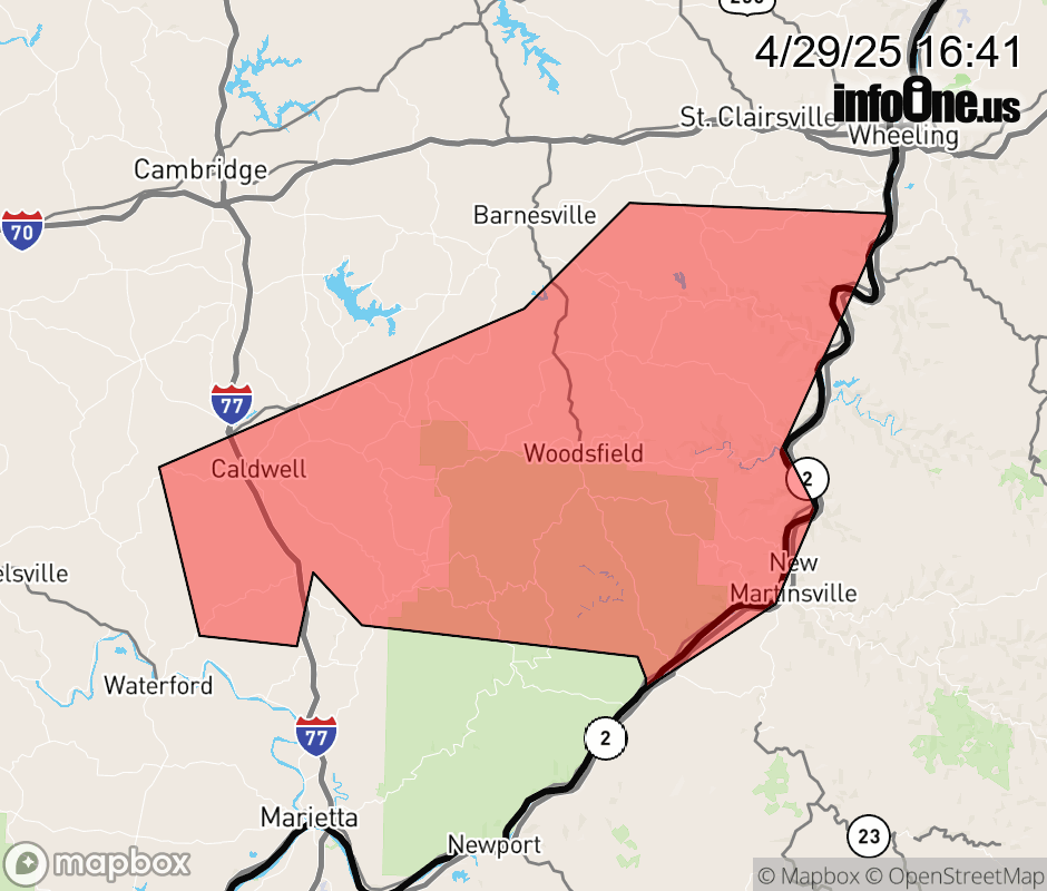 |
|||||||||
 Why aren't you using the InfoOne app? Why aren't you using the InfoOne app?
Stay abreast of information affecting your community! InfoOne tracks real-time information such as:
InfoOne currently supports over 100 communities in NC, VA and WV, and our coverage area is steadily growing. It's free! Install the InfoOne app today and see what you've been missing. |
|||||||||