|
|
Weather Alert |
| Pocahontas County, WV | |||||||||
|
|
||||||||
|
Canceled 4/29/25 11:24 PM Severe Thunderstorm Warning issued April 29 at 10:45PM EDT until April 29 at 11:30PM EDT by NWS Charleston WV SVRRLX The National Weather Service in Charleston West Virginia has issued a * Severe Thunderstorm Warning for... Southwestern Randolph County in northeastern West Virginia... Southwestern Pocahontas County in northeastern West Virginia... Southeastern Nicholas County in southeastern West Virginia... Southern Webster County in northeastern West Virginia... East central Fayette County in southeastern West Virginia... * Until 1130 PM EDT. * At 1045 PM EDT, a severe thunderstorm was located near Summersville, moving east at 45 mph. HAZARD...60 mph wind gusts. SOURCE...Radar indicated. IMPACT...Expect damage to roofs, siding, and trees. * Locations impacted include... Edray, Buckeye, Marlinton, Hillsboro, Richwood, Canvas, Cranberry Mountain Nature Center, Slaty Fork, Craigsville, Minnehaha Springs, and Nettie. This includes Route 19 between mile markers 25 and 32. 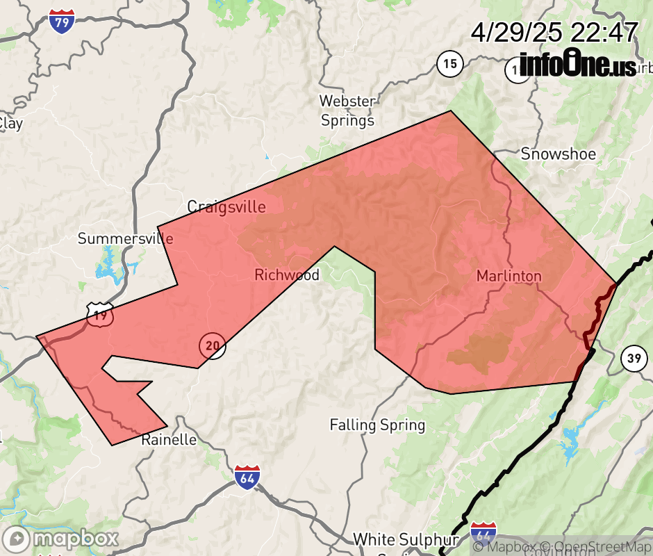 |
|||||||||
 Why aren't you using the InfoOne app? Why aren't you using the InfoOne app?
Stay abreast of information affecting your community! InfoOne tracks real-time information such as:
InfoOne currently supports over 100 communities in NC, VA and WV, and our coverage area is steadily growing. It's free! Install the InfoOne app today and see what you've been missing. |
|||||||||