|
|
Weather Alert |
| Moore County, NC | |||||||||
|
|
||||||||
|
Canceled 5/2/25 8:38 PM Severe Thunderstorm Warning issued May 2 at 8:01PM EDT until May 2 at 8:45PM EDT by NWS Raleigh NC SVRRAH The National Weather Service in Raleigh has issued a * Severe Thunderstorm Warning for... Northwestern Moore County in central North Carolina... Montgomery County in central North Carolina... * Until 845 PM EDT. * At 801 PM EDT, a severe thunderstorm was located 10 miles northeast of Ansonville, or 11 miles southwest of Troy, moving northeast at 25 mph. HAZARD...60 mph wind gusts and penny size hail. SOURCE...Radar indicated. IMPACT...Expect damage to roofs, siding, and trees. * Locations impacted include... Troy, Biscoe, Mount Gilead, Robbins, Star, Candor, Uwharrie Haven, Steeds, Seven Lakes, and Eagle Springs. 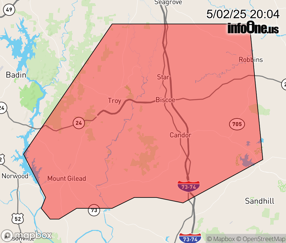 |
|||||||||
 Why aren't you using the InfoOne app? Why aren't you using the InfoOne app?
Stay abreast of information affecting your community! InfoOne tracks real-time information such as:
InfoOne currently supports over 100 communities in NC, VA and WV, and our coverage area is steadily growing. It's free! Install the InfoOne app today and see what you've been missing. |
|||||||||