|
|
Weather Alert |
| Durham County, NC | |||||||||
|
|
||||||||
|
Canceled 5/2/25 5:16 PM Special Weather Statement issued May 2 at 4:32PM EDT by NWS Raleigh NC At 432 PM EDT, Doppler radar was tracking a strong thunderstorm 12 miles northeast of Siler City, moving northeast at 25 mph. HAZARD...Wind gusts in excess of 30 mph and pea size hail. SOURCE...Radar indicated. IMPACT...Gusty winds could knock down tree limbs and blow around unsecured objects. Minor hail damage to vegetation is possible. Locations impacted include... Durham, Chapel Hill, Hillsborough, Carrboro, Sutphin, Cane Creek Reservoir, Saxapahaw, Eno River State Park, and Jordan Lake. 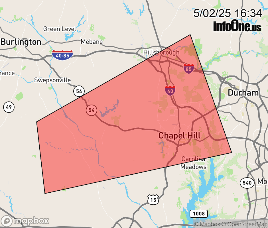 |
|||||||||
 Why aren't you using the InfoOne app? Why aren't you using the InfoOne app?
Stay abreast of information affecting your community! InfoOne tracks real-time information such as:
InfoOne currently supports over 100 communities in NC, VA and WV, and our coverage area is steadily growing. It's free! Install the InfoOne app today and see what you've been missing. |
|||||||||