|
|
Weather Alert |
| Franklin County, OH | |||||||||
|
|
||||||||
|
Canceled 6/6/26 12:30 PM Severe Thunderstorm Warning issued June 6 at 12:05PM EDT until June 6 at 12:30PM EDT by NWS Wilmington OH At 1204 PM EDT, a severe thunderstorm was located near Johnstown, moving east at 50 mph. HAZARD...60 mph wind gusts and penny size hail. SOURCE...Radar indicated. At 1155 AM, a wind gust of 66 mph occurred at The Ohio State University Airport. IMPACT...Expect damage to trees and power lines. Locations impacted include... Columbus, Newark, Westerville, Reynoldsburg, Upper Arlington, Gahanna, Worthington, Bexley, Heath, Granville, Pataskala, Johnstown, Sunbury, Buckeye Lake, Hebron, Utica, Minerva Park, Hanover, Marne, and Beechwood Trails. This includes the following Interstates... I-70 in Ohio between mile markers 93 and 96, near mile marker 115, and between mile markers 129 and 134. I-71 in Ohio between mile markers 109 and 138. 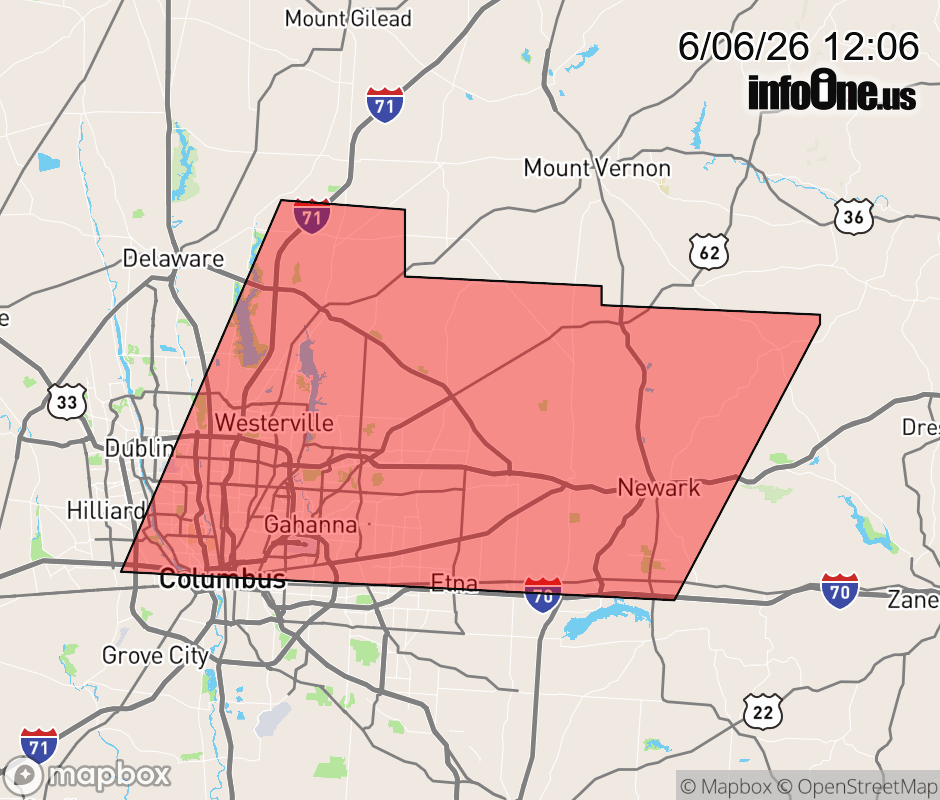 |
|||||||||
 Why aren't you using the InfoOne app? Why aren't you using the InfoOne app?
Stay abreast of information affecting your community! InfoOne tracks real-time information such as:
InfoOne currently supports over 100 communities in NC, VA and WV, and our coverage area is steadily growing. It's free! Install the InfoOne app today and see what you've been missing. |
|||||||||