|
|
Weather Alert |
| Roanoke County, VA | |||||||||
|
|
||||||||
|
Canceled 8/12/25 5:15 PM Special Weather Statement issued August 12 at 4:51PM EDT by NWS Blacksburg VA At 448 PM EDT, Doppler radar was tracking a cluster of heavy showers, that may become thunderstorms along a line extending from Blacksburg to near Crockett Springs. Movement was northeast at 5 mph. Rainfall rates of 2 to 4 inches an hour were occurring with these showers. HAZARD...Low lying flooding, ponding of water on roads. SOURCE...Radar indicated. IMPACT...Rainfall this heavy will lead to poor drainage flooding and some street flooding. Slow down to avoid hydroplaning. Locations impacted include... Blacksburg... Christiansburg... Bent Mountain... Shawsville... Mc Donalds Mill... Elliston-Lafayette... and Merrimac. 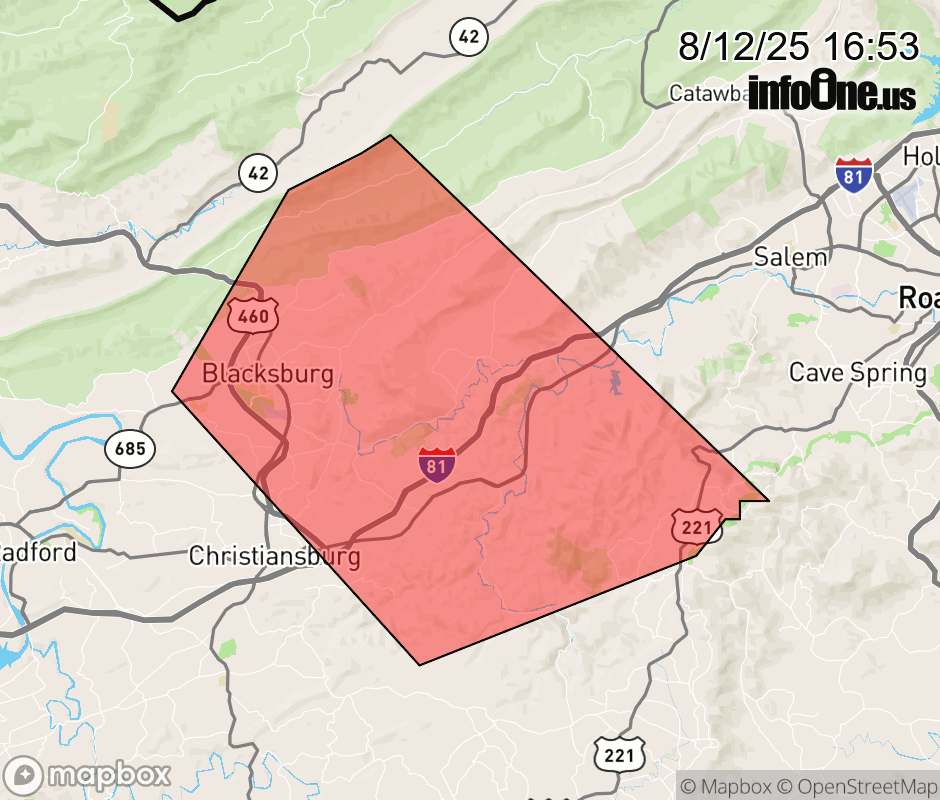 |
|||||||||
 Why aren't you using the InfoOne app? Why aren't you using the InfoOne app?
Stay abreast of information affecting your community! InfoOne tracks real-time information such as:
InfoOne currently supports over 100 communities in NC, VA and WV, and our coverage area is steadily growing. It's free! Install the InfoOne app today and see what you've been missing. |
|||||||||