|
|
Weather Alert |
| Stark County, OH | |||||||||
|
|
||||||||
|
Canceled 5/2/25 4:04 PM Severe Thunderstorm Warning issued May 2 at 3:28PM EDT until May 2 at 4:15PM EDT by NWS Cleveland OH SVRCLE The National Weather Service in Cleveland has issued a * Severe Thunderstorm Warning for... Southwestern Stark County in northeastern Ohio... Southern Wayne County in northeastern Ohio... Holmes County in northeastern Ohio... * Until 415 PM EDT. * At 328 PM EDT, a severe thunderstorm was located over Holmesville, or near Millersburg, moving east at 35 mph. HAZARD...60 mph wind gusts and quarter size hail. SOURCE...Radar indicated. IMPACT...Minor damage to vehicles is possible. Expect damage to trees and power lines. * Locations impacted include... Millersburg, Massillon, Berlin, Walnut Creek, Sugarcreek, Brewster, Shreve, Killbuck, Holmesville, Wilmot, Glenmont, Mount Eaton, Nashville, Winesburg, Farmerstown, Apple Creek, Beach City, Fredericksburg, Mount Hope, and Charm. 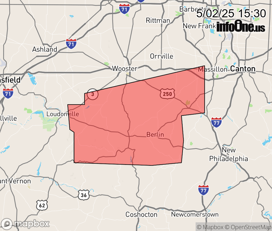 |
|||||||||
 Why aren't you using the InfoOne app? Why aren't you using the InfoOne app?
Stay abreast of information affecting your community! InfoOne tracks real-time information such as:
InfoOne currently supports over 100 communities in NC, VA and WV, and our coverage area is steadily growing. It's free! Install the InfoOne app today and see what you've been missing. |
|||||||||