|
|
Weather Alert |
| Washington County, OH | |||||||||
|
|
||||||||
|
Canceled 6/6/26 2:45 PM Special Weather Statement issued June 6 at 2:00PM EDT by NWS Charleston WV At 159 PM EDT, Doppler radar was tracking strong thunderstorms along a line extending from 7 miles west of Caldwell to Chesterhill. Movement was southeast at 40 mph. HAZARD...Wind gusts up to 40 mph and pea size hail. SOURCE...Radar indicated. IMPACT...Gusty winds could knock down tree limbs and blow around unsecured objects. Minor hail damage to vegetation is possible. Locations impacted include... Marietta, St. Marys, Beverly, Chesterhill, Williamstown, Belmont, Newport, Matamoras, Lowell, Stockport, Bristol, Macksburg, Lower Salem, Hackney, and Devola. This includes Interstate 77 in Ohio between mile markers 1 and 17. 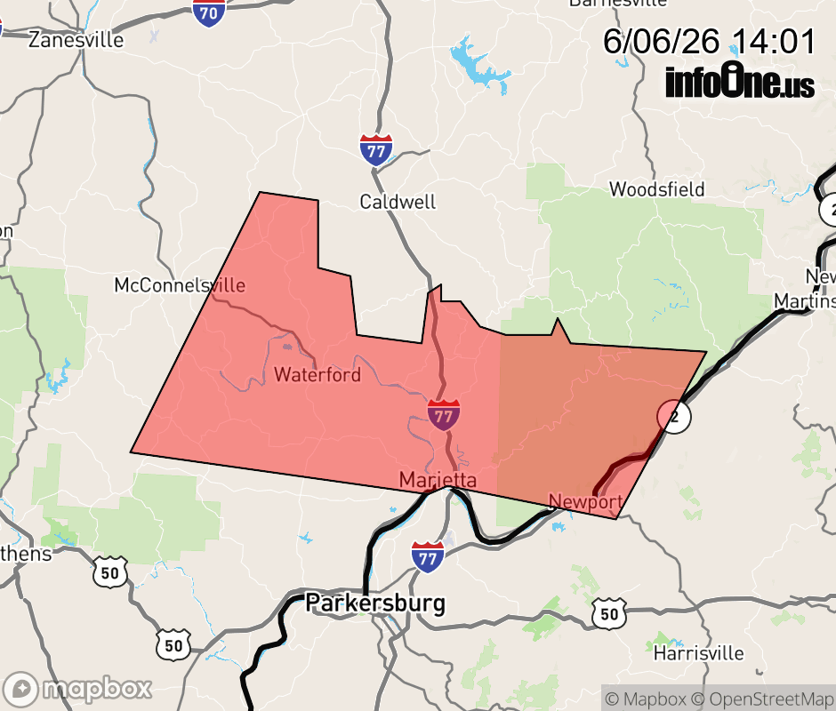 |
|||||||||
 Why aren't you using the InfoOne app? Why aren't you using the InfoOne app?
Stay abreast of information affecting your community! InfoOne tracks real-time information such as:
InfoOne currently supports over 100 communities in NC, VA and WV, and our coverage area is steadily growing. It's free! Install the InfoOne app today and see what you've been missing. |
|||||||||