|
|
Weather Alert |
| Franklin County, OH | |||||||||
|
|
||||||||
|
Canceled 6/26/25 3:12 PM Severe Thunderstorm Warning issued June 26 at 2:38PM EDT until June 26 at 3:30PM EDT by NWS Wilmington OH SVRILN The National Weather Service in Wilmington has issued a * Severe Thunderstorm Warning for... Southeastern Franklin County in central Ohio... Northwestern Fairfield County in central Ohio... North central Pickaway County in central Ohio... Southwestern Licking County in central Ohio... * Until 330 PM EDT. * At 238 PM EDT, a severe thunderstorm was located near Groveport, moving east at 15 mph. HAZARD...60 mph wind gusts and penny size hail. SOURCE...Radar indicated. IMPACT...Expect damage to trees and power lines. * Locations impacted include... Columbus, Reynoldsburg, Grove City, Gahanna, Pickerington, Bexley, Pataskala, Canal Winchester, Groveport, Baltimore, Beechwood Trails, Summit Station, Whitehall, Etna, New Albany, Grandview Heights, Obetz, Jersey, Lithopolis, and Kirkersville. This includes the following Interstates... I-70 in Ohio between mile markers 97 and 123. I-71 in Ohio between mile markers 102 and 111. 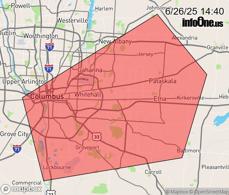 |
|||||||||
 Why aren't you using the InfoOne app? Why aren't you using the InfoOne app?
Stay abreast of information affecting your community! InfoOne tracks real-time information such as:
InfoOne currently supports over 100 communities in NC, VA and WV, and our coverage area is steadily growing. It's free! Install the InfoOne app today and see what you've been missing. |
|||||||||