|
|
Weather Alert |
| Johnson County, TN | |||||||||
|
|
||||||||
|
Canceled 8/13/25 2:55 PM Flood Watch issued August 13 at 1:45PM EDT until August 13 at 8:00PM EDT by NWS Morristown TN * WHAT... Flash flooding caused by excessive rainfall continues to be possible. * WHERE... Portions of southwest North Carolina, including the following areas, Cherokee and Clay, east Tennessee, including the following areas, Anderson, Bledsoe, Blount Smoky Mountains, Bradley, Campbell, Claiborne, Cocke Smoky Mountains, East Polk, Grainger, Hamblen, Hamilton, Hancock, Hawkins, Jefferson, Johnson, Knox, Loudon, Marion, McMinn, Meigs, Morgan, North Sevier, Northwest Blount, Northwest Carter, Northwest Cocke, Northwest Greene, Northwest Monroe, Rhea, Roane, Scott TN, Sequatchie, Sevier Smoky Mountains, Southeast Carter, Southeast Greene, Southeast Monroe, Sullivan, Unicoi, Union, Washington TN and West Polk, and southwest Virginia, including the following areas, Lee, Russell, Scott VA, Washington VA and Wise. * WHEN... Until 8 PM EDT /7 PM CDT/ this evening. * IMPACTS... Flooding may occur in poor drainage and urban areas. Extensive street flooding and flooding of creeks and rivers are possible. * ADDITIONAL DETAILS... - Rain coverage and intensity will continue to decrease through the rest of the afternoon. However, some showers will still be capable of producing locally heavy rainfall that may lead to flooding. Some areas are currently experiencing flooding of roads, creeks, and streams, and it will take several hours for all the water to recede. - http://www.weather.gov/safety/flood 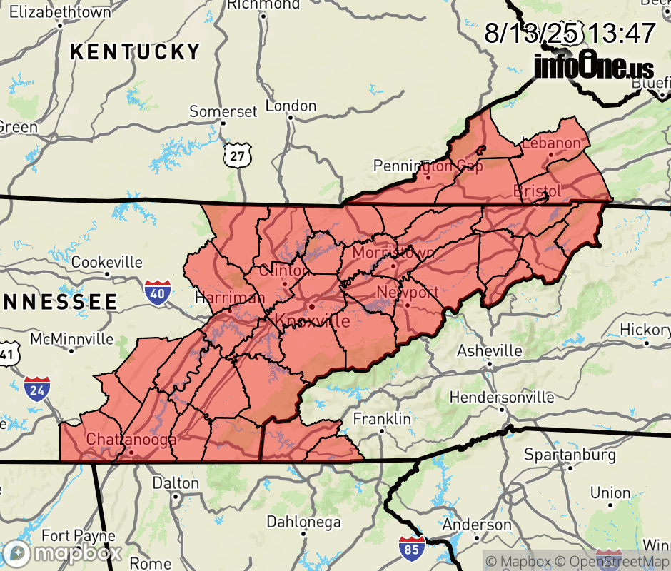 |
|||||||||
 Why aren't you using the InfoOne app? Why aren't you using the InfoOne app?
Stay abreast of information affecting your community! InfoOne tracks real-time information such as:
InfoOne currently supports over 100 communities in NC, VA and WV, and our coverage area is steadily growing. It's free! Install the InfoOne app today and see what you've been missing. |
|||||||||