|
|
Weather Alert |
| Ashe County, NC | |||||||||
|
|
||||||||
|
Canceled 6/28/25 8:04 PM Flood Advisory issued June 28 at 5:05PM EDT until June 28 at 8:15PM EDT by NWS Blacksburg VA * WHAT... Flooding caused by excessive rainfall is expected. * WHERE... A portion of northwest North Carolina, including the following counties, Ashe and Wilkes. * WHEN... Until 815 PM EDT. * IMPACTS... Minor flooding in low-lying and poor drainage areas. * ADDITIONAL DETAILS... - At 505 PM EDT, Doppler radar indicated heavy rain due to thunderstorms. Minor flooding is ongoing or expected to begin shortly in the advisory area. Between 1 and 1.5 inches of rain have fallen. - This includes the following streams and drainages... Cane Creek, Church Branch, Fall Creek, Clear Branch, Mill Creek, Camp Branch, Elk Creek, Middle Fork Reddies River, Mulberry Creek, Little Fork, Little Fork Creek, Middle Prong Roaring River, Fish Dam Creek, Bee Tree Branch, Left Prong Stony Fork and Darnell Creek. Additional rainfall amounts of 0.5 to 1 inch are expected over the area. This additional rain will result in minor flooding. - Some locations that will experience flooding include... North Wilkesboro... Wilbar... Millers Creek... Maple Springs... Buck... Summit... Halls Mills... - http://www.weather.gov/safety/flood 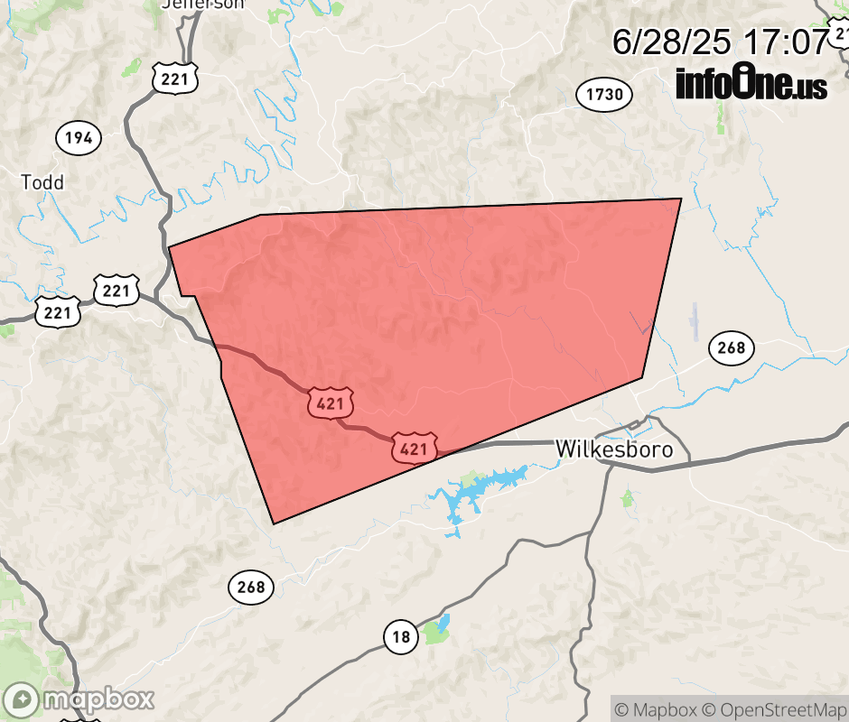 |
|||||||||
 Why aren't you using the InfoOne app? Why aren't you using the InfoOne app?
Stay abreast of information affecting your community! InfoOne tracks real-time information such as:
InfoOne currently supports over 100 communities in NC, VA and WV, and our coverage area is steadily growing. It's free! Install the InfoOne app today and see what you've been missing. |
|||||||||