|
|
Weather Alert |
| Johnson County, TN | |||||||||
|
|
||||||||
|
Canceled 8/13/25 1:24 PM Flash Flood Warning issued August 13 at 10:50AM EDT until August 13 at 2:00PM EDT by NWS Morristown TN At 1050 AM EDT, trained weather spotters and radar reported thunderstorms producing heavy rain near Bluff City. Between 2 and 3.5 inches of rain have fallen. Additional rainfall amounts of 0.5 to 1 inch are possible in the warned area. Flash flooding is already occurring. HAZARD...Flash flooding caused by thunderstorms. SOURCE...Trained spotters reported. IMPACT...Flash flooding of small creeks and streams, urban areas, highways, streets and underpasses as well as other poor drainage and low-lying areas. Some locations that will experience flash flooding include... Kingsport, Bristol Tn, Bristol Va, Elizabethton, Mountain City, Walnut Hill, Bluff City, Damascus, South Holston Dam, Sadie, Harr, Shady Valley, Doeville, Hunter, Hilander Park, Morril's Cave, Neva, Elk Mills, Benhams and Blountville. 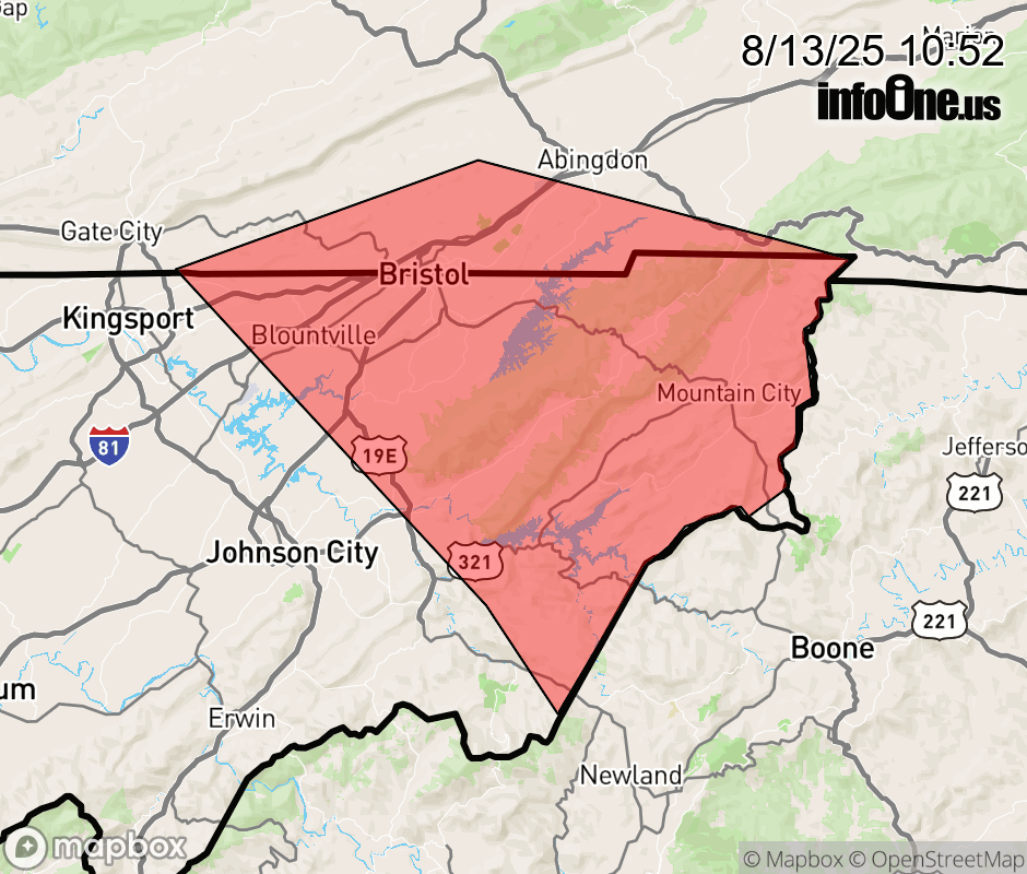 |
|||||||||
 Why aren't you using the InfoOne app? Why aren't you using the InfoOne app?
Stay abreast of information affecting your community! InfoOne tracks real-time information such as:
InfoOne currently supports over 100 communities in NC, VA and WV, and our coverage area is steadily growing. It's free! Install the InfoOne app today and see what you've been missing. |
|||||||||