|
|
Weather Alert |
| Montgomery County, VA | |||||||||
|
|
||||||||
|
Canceled 8/11/25 11:45 PM Flood Advisory issued August 11 at 10:57PM EDT until August 12 at 12:30AM EDT by NWS Blacksburg VA * WHAT... Flooding caused by excessive rainfall continues. * WHERE... Portions of southwest and west central Virginia, including the following counties, in southwest Virginia, Montgomery. In west central Virginia, Franklin and Roanoke. * WHEN... Until 1230 AM EDT. * IMPACTS... Minor flooding in low-lying and poor drainage areas. * ADDITIONAL DETAILS... - At 1055 PM EDT, Gauges indicated that up to 2.5 inches of rain had fallen in portions of the area, especially near the Blue Ridge Parkway north of Bent Mountain. Another band of heavier showers could bring another half inch of rain by 1145 PM. Minor flooding is ongoing or expected to begin shortly in the advisory area. - This includes the following streams and drainages... Lick Fork, Little River, Little Creek, Big Bear Rock Branch, Dry Branch, Back Creek and Brake Branch. Additional rainfall amounts up to 0.5 inches are expected over the area. This additional rain will result in minor flooding. - Some locations that will experience flooding include... Boones Mill... Bent Mountain... Shawsville... Poages Mill... Cave Spring... Glenvar... Elliston-Lafayette... - http://www.weather.gov/safety/flood 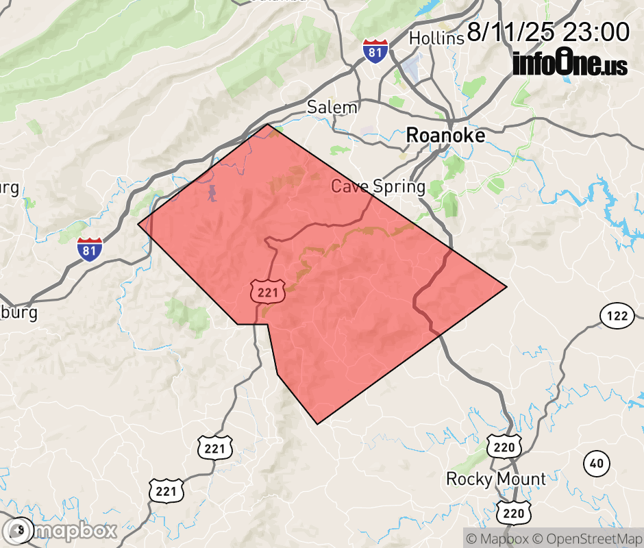 |
|||||||||
 Why aren't you using the InfoOne app? Why aren't you using the InfoOne app?
Stay abreast of information affecting your community! InfoOne tracks real-time information such as:
InfoOne currently supports over 100 communities in NC, VA and WV, and our coverage area is steadily growing. It's free! Install the InfoOne app today and see what you've been missing. |
|||||||||